

Best Photo Spots in Broken Bow
Living in Plano, TX (just outside of Dallas), I always crave hiking in the piney woods and mountains. It is not always an option to hop in the car and go to New Mexico or Southern Colorado for a weekend, but Broken Bow in southeastern Oklahoma is an easy getaway location. Only 3 hours from my home, I can load up the dogs and go to Hochatown, the closest town to Beavers Bend State Park, for a couple of nights.
With the highest elevation of 679 feet, the Kiamici Mountains in Beavers Bend are not tall in comparison to the Rockies, but when you are used to the flat landscape around Plano, TX, hiking in Beavers Bend is a real treat. I love taking photos and videos while hiking in the area - here are some of my favorite photos and a few stories that go along with them. I am a beginner landscape photographer, but I love finding AND SHARING scenic spots. Leave a message in the comments with your favorite places for photography in Beavers Bend. I am always looking for new locations. Each photo has a link to Google Maps and/or AllTrails to show the location of the photo in case you want to go to that spot - hope you do.
Photo Spot 1: What Could be Around the Bend?

Remote Area of Broken Bow Lake on a Foggy (and Rainy) Morning
I typically choose marked and maintained trails for my adventures, but some journeys are best when you go off the well-worn paths. I woke up on a Saturday morning to an eerie fog looming in the boughs of the trees at my cabin. I immediately knew that I needed to find a good spot on the lake to capture some photos. I threw on my hiking boots and my regular overcoat - big mistake! I soon would be wishing that I had grabbed my rain gear… lesson learned.
For a map to the location: Click HERE. It is a bit tricky to find this spot. I drove north on Highway 259 past the turn to the Cedar Creek Golf Course and found a gravel, county road (54000) on the right. The road started out fairly smooth for about 5 miles and then I reached a fork in the road. I chose the left fork, and the road was rough. I drive a CRV, and it was fine, but I would recommend high clearance. I drove another 1.5 miles down this fork of the road until I could drive no further. Then I parked and hiked until I reached the lake. I climbed down the steep embankment to the shore for this photo.
I was interested in this bend in the lake because of the layers it created in the photo. It made me wonder what is right around the bend. I liked that mystery - especially because of the moody fog that was moving through the pines on the hills in the background. I loved this area - and I was the only person there. It was hard to get to, but the reward was solitude and peace. Well, until it started pouring on me. And remember, I did not have the right gear for rain. I didn’t care. I just kept focusing on the landscape as the rain showers came and went. I was soaked - but I was loving what I was doing.

Focusing on the Stones in the Foreground with Sunset in the Back
Photo Spot 2: Sunset at the Coyote Drive Camping Area
A much easier spot to get to is the Coyote Drive Camping Area off of Stephen’s Gap Road. Click HERE for a map to the location. This little peninsula offers views of a cove to the west and out to Broken Bow Lake to the north and east. When in this area, I am always drawn to the beauty of the stones in and around Beavers Bend. On this evening, I felt that the sunset was casting such a gorgeous light trail on the stones at my feet. I got placed my camera right on the ground and focused on the rocks instead of the sunset. I know that there are different views on landscape photography and having the whole image in focus, but I feel that this photo works with the immediate foreground and sunset out of focus with the illuminated rocks as the sharpest part of the photo. The sunset is powerful, but what it does to the stones was more interesting to me at the moment. It made me think of how good that people do can shine a light on others and inspire them. I took many pics in this area that did not work for me, but there is something about this one that I really enjoy.
Photo Spot 3: The River Crossings in the Park
In the park, there is a loop created by Beavers Bend Road and 259A. While driving this loop, there are three spots where the road crosses the Mountain Fork River. All three of these locations are amazing - and easy - photo spots. For safety, please be sure not to stand on the bridges to take your photos.
The crossing near Evening Hole (Click HERE for a map) is a wonderful place to capture photos of people fly fishing. Wading into the water or standing along the shore, people are almost always fishing in this area. The second crossing is right next to the Beavers Bend Fly Shop (Click HERE for a map), and again, you will see people fishing here, but there is so much more to photograph at this location. At this spot, people can rent canoes and kayaks. These make for a great subject of your photos with the cypress trees in the background. Also, the sun sets in this area can be great to capture. The low sun casts a beautiful light on the river, and colorful clouds can provide added visual interest to an already pretty view. Note: Be sure to look both ways on the Mountain Fork because there are shots in both directions.
The third crossing is near the Beavers Bend Paddle Boat Rental, a beach area, and the power plant (Click HERE for a map). This is my favorite of the three crossings. There is a small peninsula on the western side of the bridge that has a lone tree standing on it. Placing the tree in the foreground of a shot with the reflection in the river can make for a strong composition. On foggy days, this is a perfect place to capture photos. Again, look the other direction (and possibly walk along the river to the east) for other views including rocky cliffs and more fly fishing. Another idea is to get out on the water to get a different perspective or some candid pics as you row along.
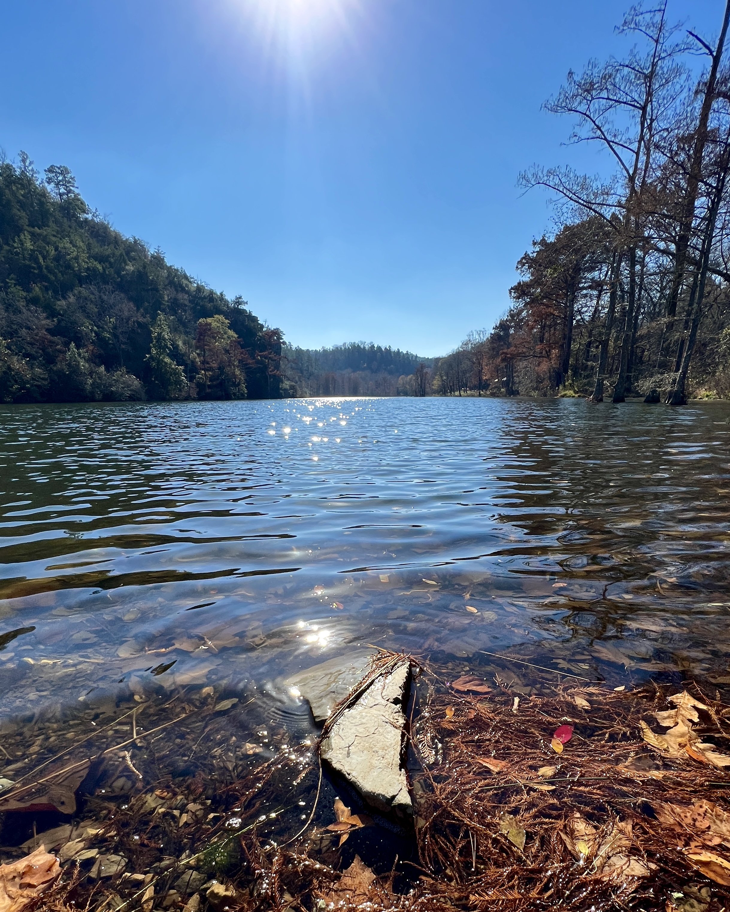
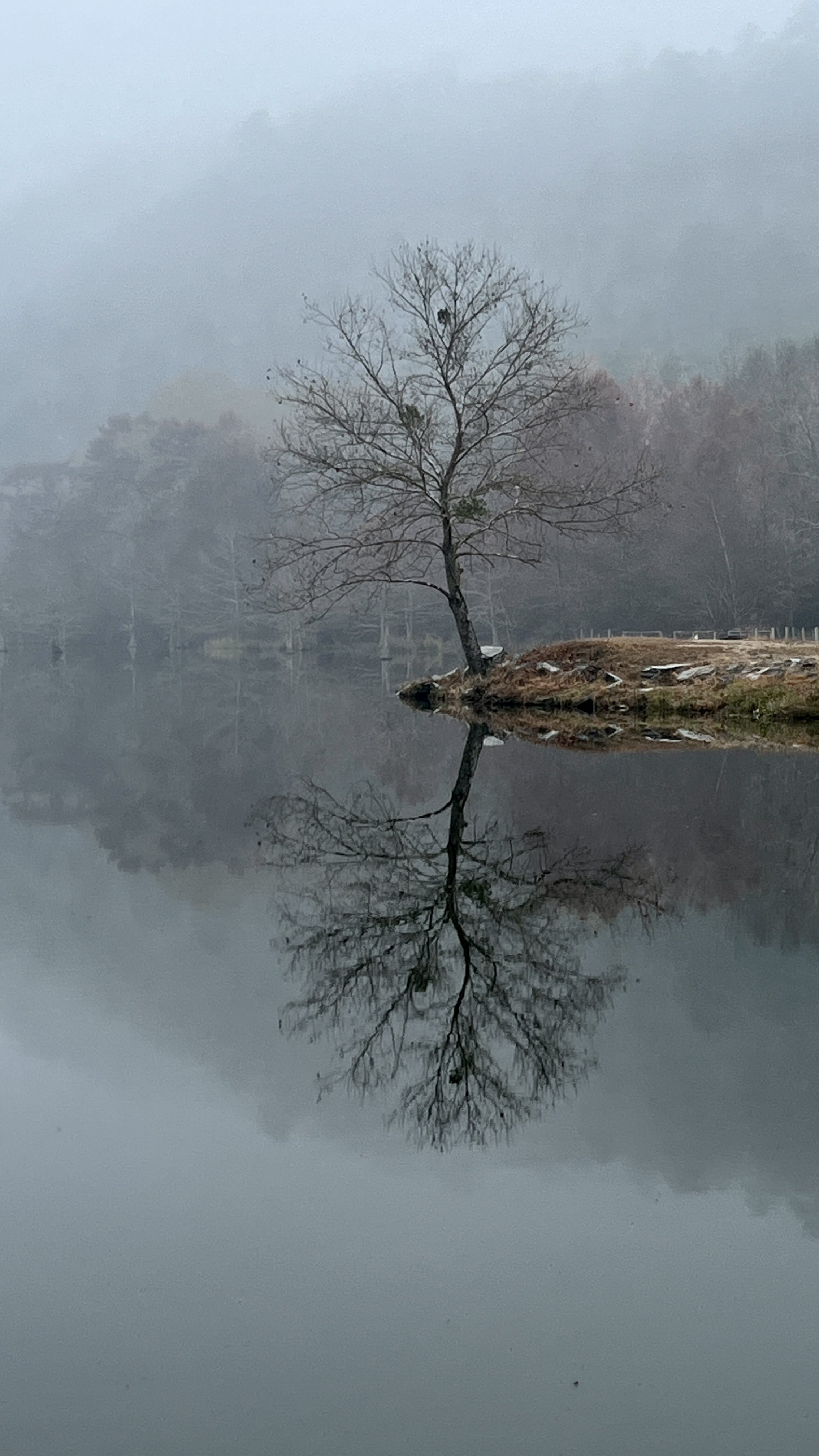
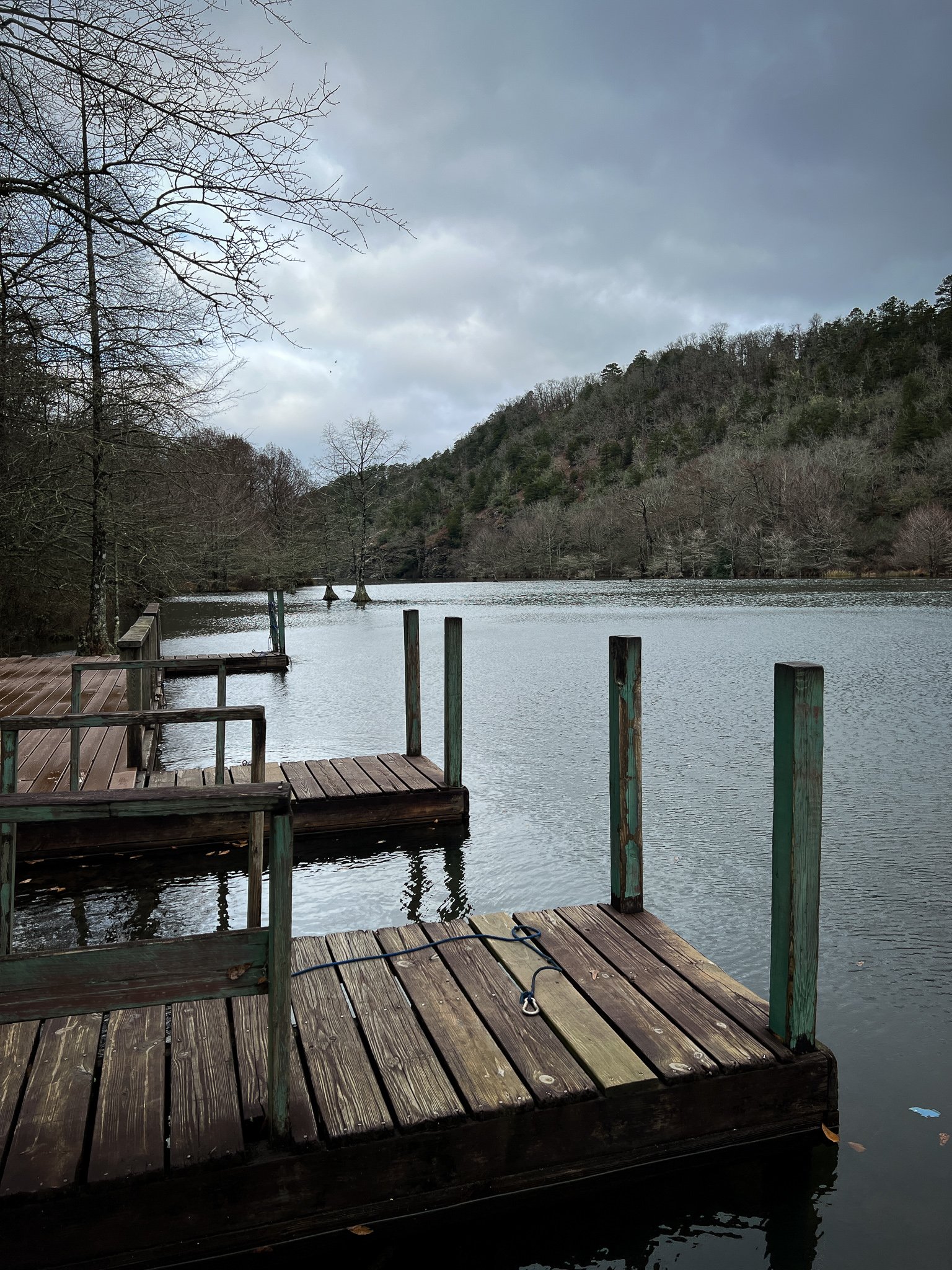
Photo Spot 4: Mountain Fork Below the Spillway
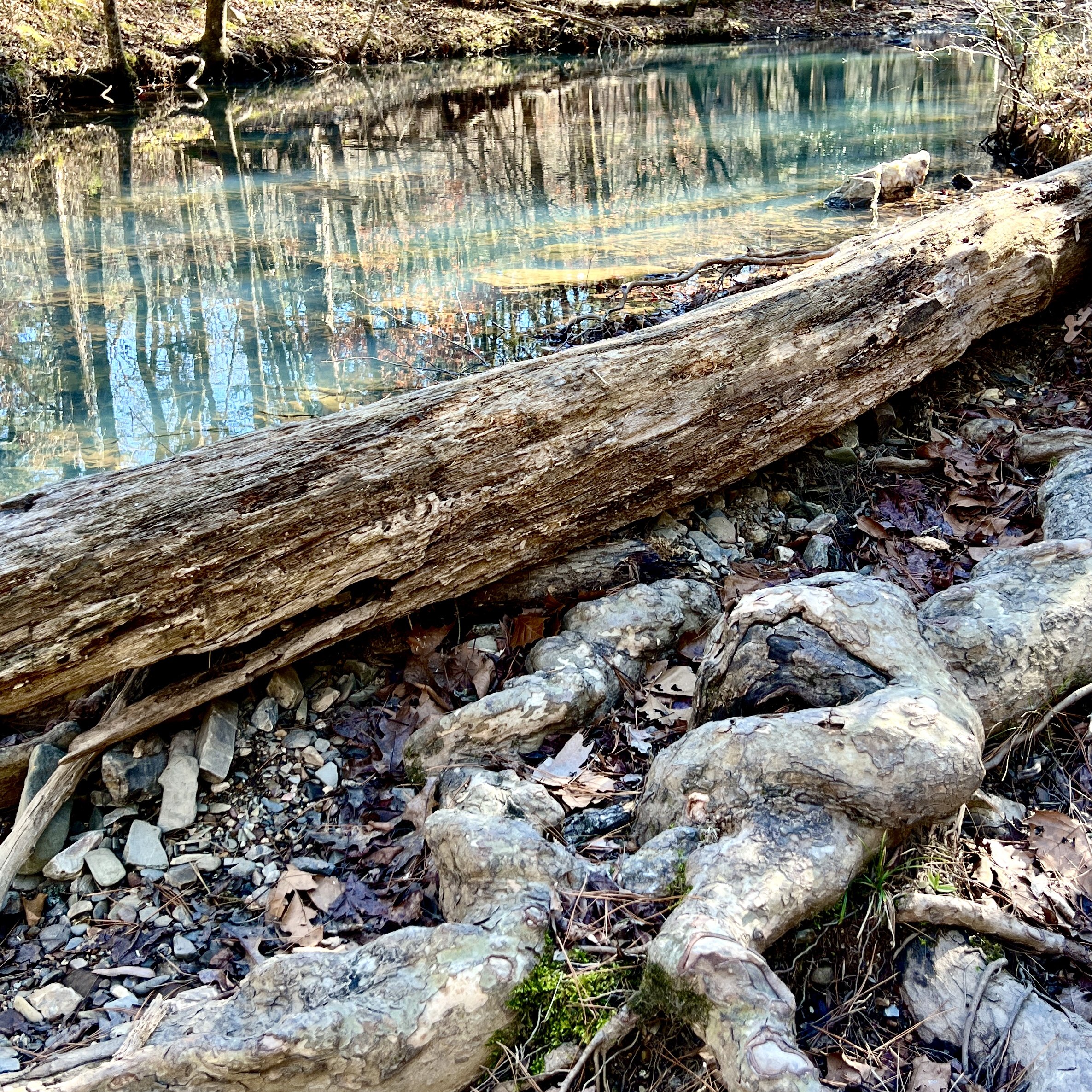
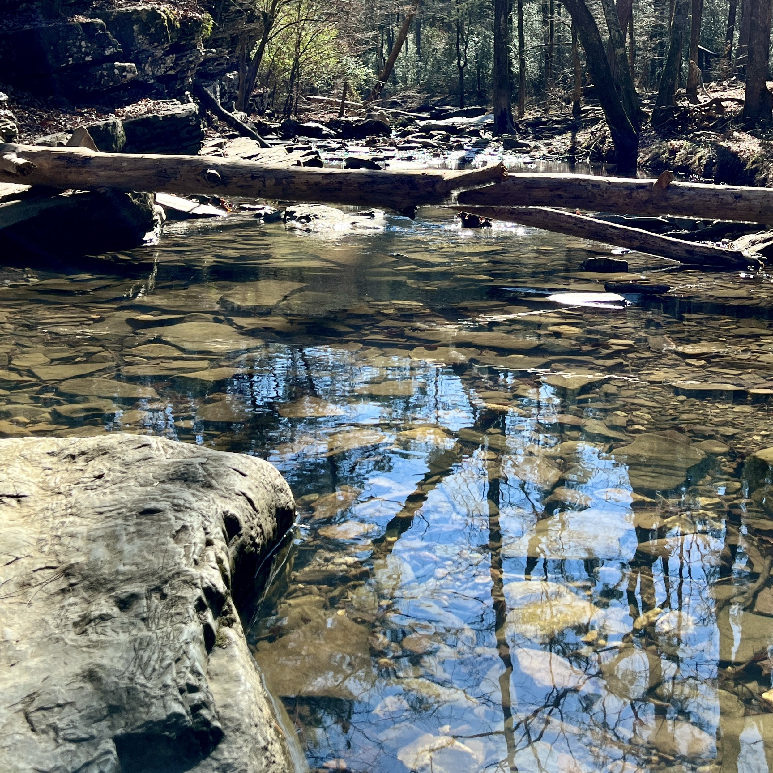
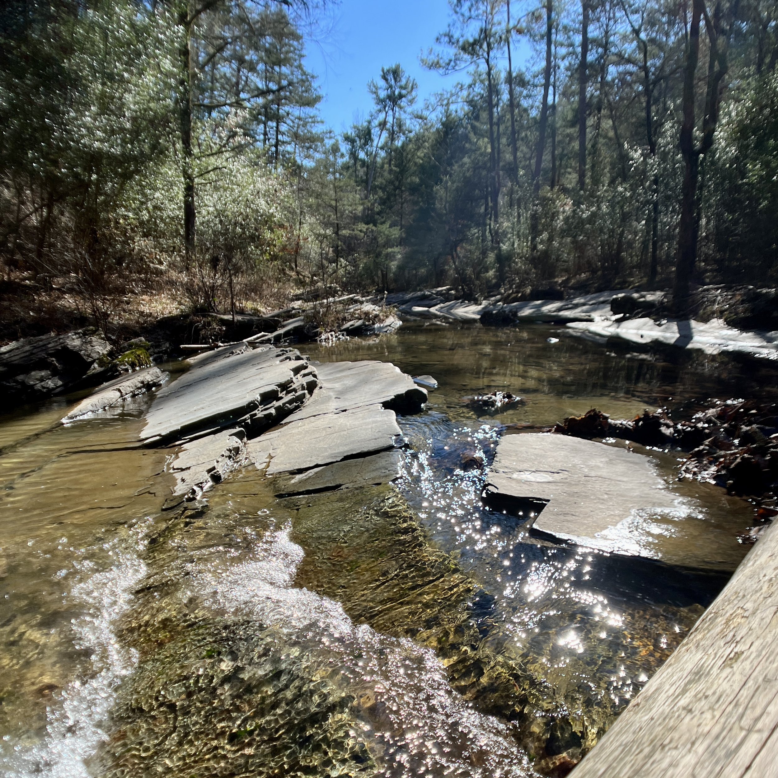
This isn’t really a spot, but it is more like an area. This is probably the stretch of the park where I spend most of my time because there are so many waterfalls, beautiful rocks, and crystal-clear water. In the 1960s, the Mountain Fork River was dammed by the Army Corps of Engineers to form Broken Bow Lake. They created a spillway to release water from the lake into the river, and the stretch of river below the spillway is stunning. You can access the river from both sides (Click HERE to see my post about the best hiking trails in Beavers Bend). From the spillway to Beavers Bend Road is approximately 3 miles of fast-moving water and cascades. Bonus: On the south end of this stretch of the river, be sure to go across Beavers Bend Road to a spot where the water gets shallow as it travels right next to a cliff. This is a perfect spot to photo people who are fishing or to focus in on the water with mossy cliffs in the background.
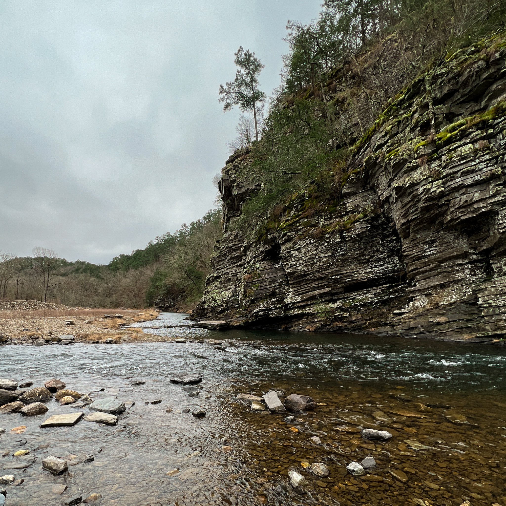
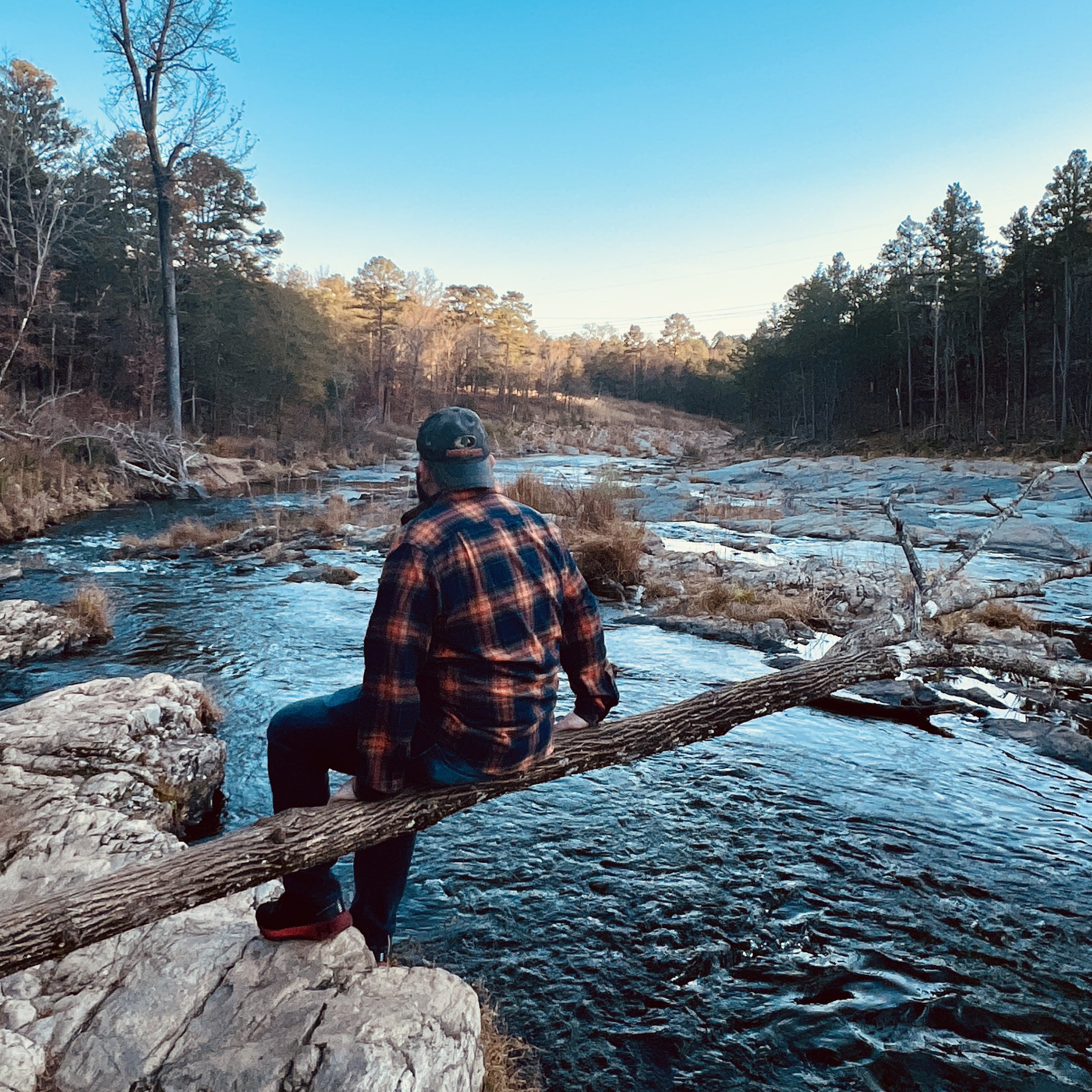
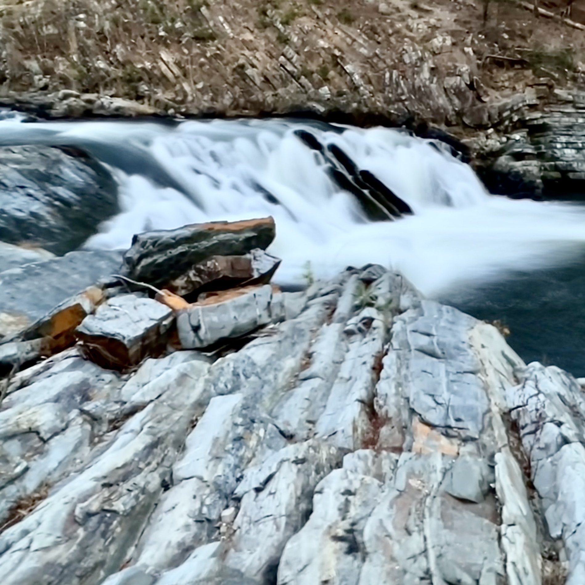
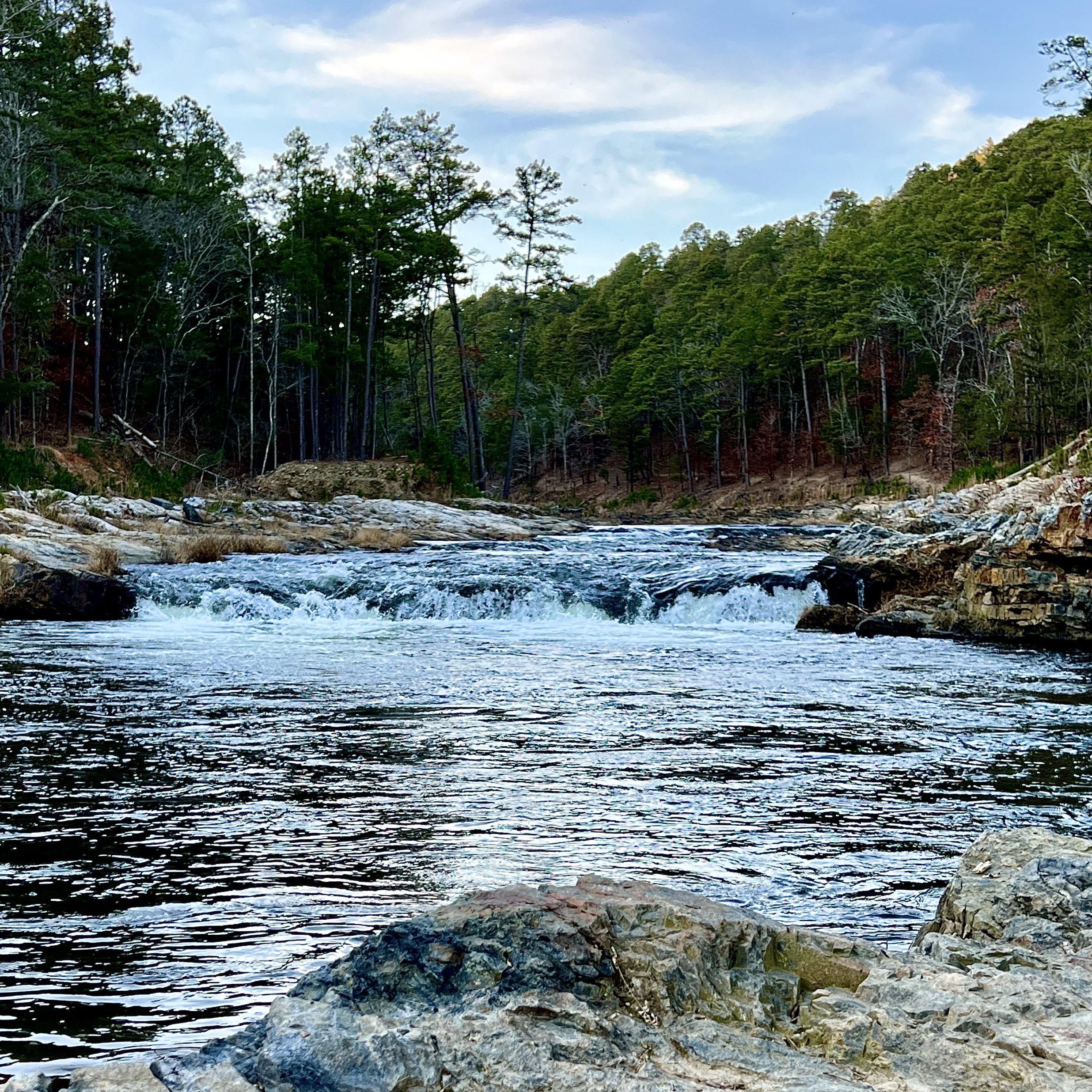
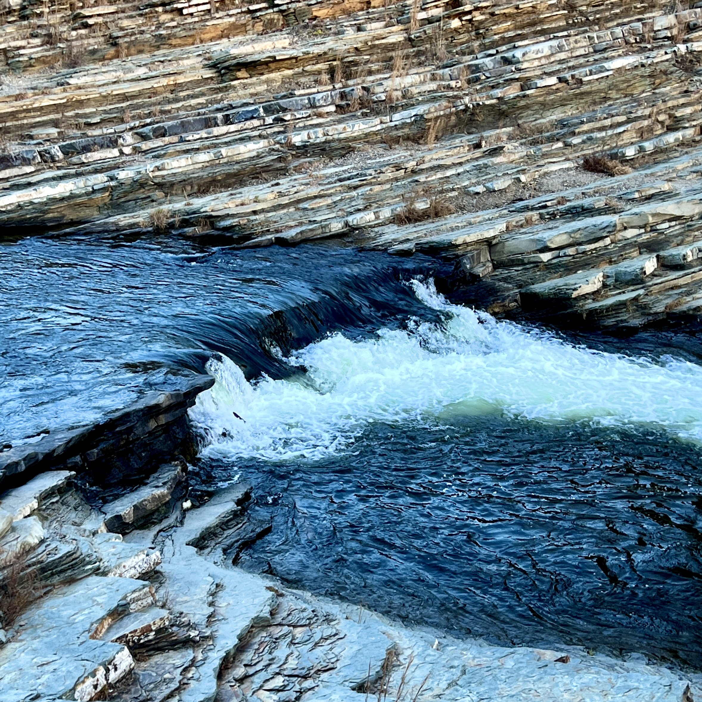
Photo Spot 5: A Tale of Two Trails

View from Cedar Bluff in the Winter
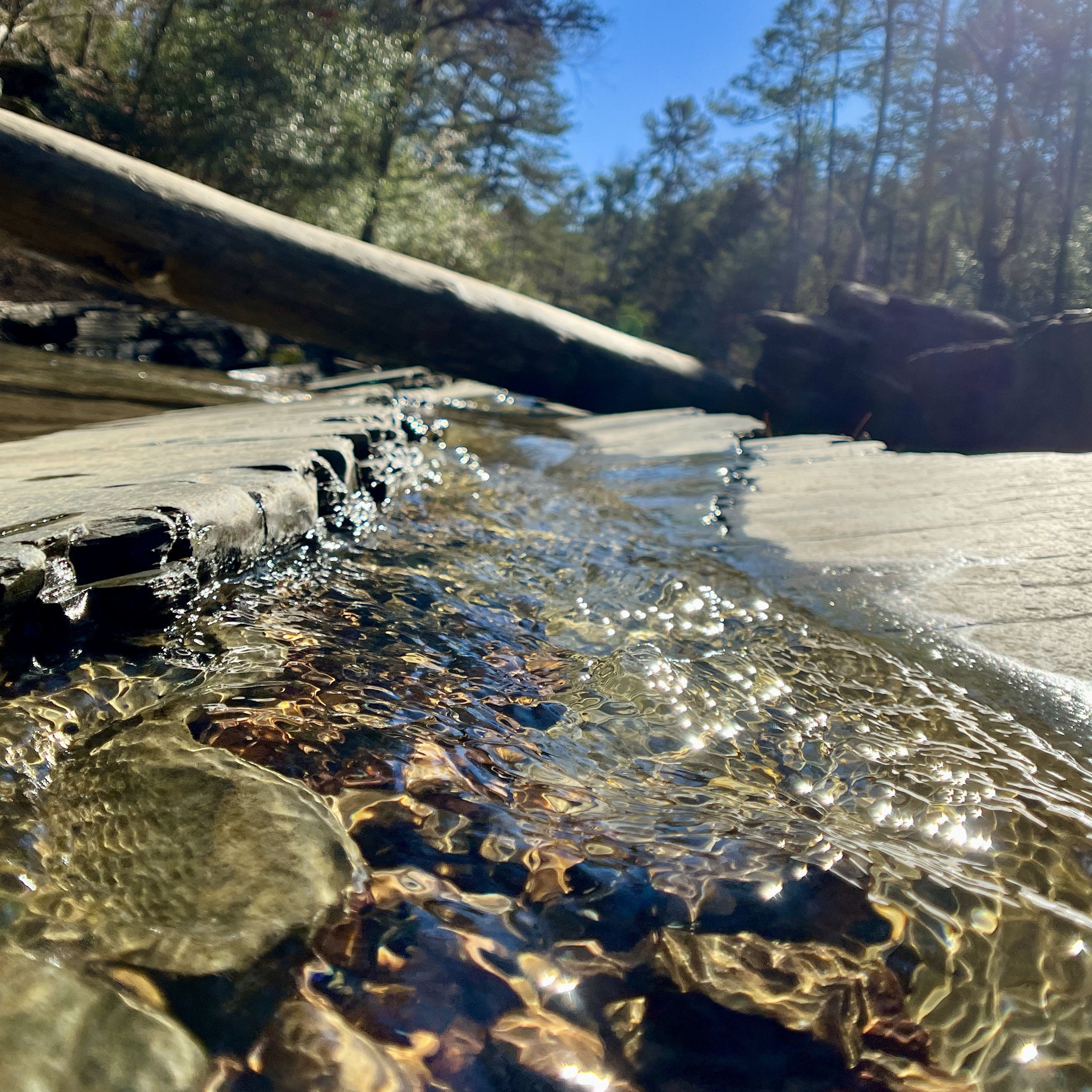
So, I couldn’t pick just one place to recommend for the fifth photo spot because I love these two spots for completely different reasons. The first trail that has endless opportunities for compositions is the Tree Trail - an easy loop near the nature center (Click HERE for a map and details from AllTrails). My favorite part of this trail is along Beaver Creek. The clear water and rocky creek bed makes for lovely images when the sun reflects on the ripples. I also think the covered bridge on the other side of the loop is a fun place for portrait photos. I will have to go back there soon. The second trail I had to include is the Cedar Bluff Nature Trail (Click HERE for a map and details from AllTrails). The forested part of this loop trail is calming and offers wonderful opportunities for macro photography of mosses and quartz rocks, but the big draw to this trail is the view from the bluff. This is the best sunset spot in the park in my opinion. The view stretches out over a bend in the Fork River with cypress trees below, and it faces west. Tip: Go to the Fern Camping area to get the reverse view - look up at the bluff from the other side of the river and get a great perspective of the cypress trees (Click HERE for a map). This is a popular photo location as well. So the final 2 locations are the Beaver Creek from the Tree Trail and the view from the bluff on the Cedar Bluff Trail (Click HERE for more information on these hikes). Photos below are along Beaver Creek.
This is only a few of the amazing places in Beavers Bend. I also love Crystal Point for sunrise and the Beavers Bend Overlook for amazing views of the lake. Also, the road going into the park (259A) is also scenic. Be careful of traffic if you are taking photos of the curvy road, but it is so pretty with the dark pavement lined with trees. I sincerely hope that this guide to photo spots in Beavers Bend inspires you to seek out some of these locations on your next trip. Share your photos on Instagram using #pinesandcoastlines. Happy trails!